Understanding Recent USDA Hardiness Zone Revisions
The USDA Plant Hardiness Zone Map can look like a simple answer to a complicated Ohio gardening question: will a plant survive winter here? Recent revisions changed the map’s picture of cold conditions, but a zone is not a planting date or a promise. Understanding what the map measures—and what it leaves out—helps you use it to choose plants without mistaking it for a complete garden calendar.
What the revised USDA hardiness map tells you
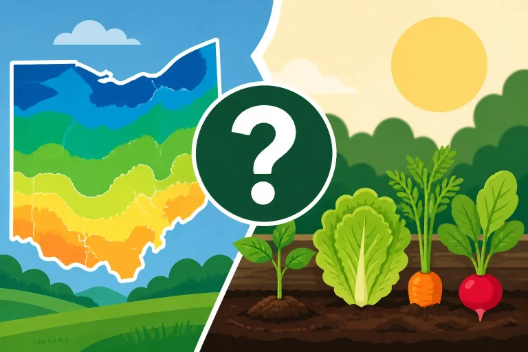
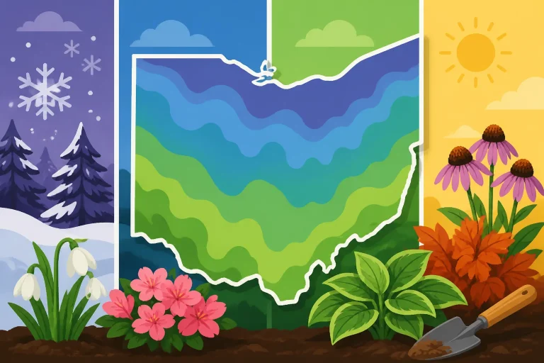
The USDA Plant Hardiness Zone Map is a tool for comparing winter cold across locations. The USDA 2023 map is based on average annual extreme minimum winter temperature, according to The Ohio State University State Climate Office of Ohio. In practical terms, the map uses a long-term view of the lowest winter temperatures in an area to group locations into hardiness zones.
The Ohio State University describes the 2023 maps as the most up to date since 2012. That update matters because the map is meant to reflect patterns of winter cold, and conditions can vary across a state as well as within a local area. A revised map gives gardeners an updated way to compare a location with the cold conditions associated with particular plants.
The map is most useful for a question like, “Is this plant likely to tolerate typical winter cold in this area?” Plant descriptions often include a hardiness range, which can help you screen choices before buying or planting. A plant listed for colder conditions may be a safer bet than one whose cold tolerance is at the edge of what the map suggests for your location.
But “likely to tolerate” is not the same as “will thrive.” A hardiness zone does not describe every winter, predict the next cold snap, or account for the complete conditions in a particular garden bed. A plant may survive winter but grow poorly because it lacks suitable light, drainage, moisture, or soil. Another may do well in a sheltered spot even when the general area is challenging for it.
For an overview of how Ohio’s geography fits into the map, see Ohio Plant Zones: How USDA Hardiness Regions Divide the State. To check a particular location, Using the Interactive USDA Zone Map for Your Ohio Address can help you find and interpret the mapped area near you. A map result is a starting point; it is not a substitute for looking at the actual planting site.
A zone describes an area, not a garden bed
The mapped zone is not a guarantee for every corner of a property. Exposure, nearby buildings, slope, wind, shade, and the way cold air moves through a yard can all make a planting spot behave differently from the broader area around it.
For example, a protected bed beside a building may experience different conditions from an open, wind-exposed bed. A low spot can also experience cold that a nearby higher area avoids. These differences do not change the map’s role: it provides a broad regional reference. They do mean that gardeners should not treat the map label as a precise description of a specific plant’s surroundings.
That distinction is especially useful when choosing a marginal plant—one that appears to be at the edge of its stated cold tolerance. Instead of relying on the map alone, consider the plant’s placement, its exposure to wind and winter sun, the soil’s drainage, and whether the site is sheltered. A zone match can make a plant worth considering; it cannot remove the risks of a difficult microclimate.
Why a zone may look different after a revision
A revised map can change how a location is categorized. That can happen without meaning that every individual winter has become mild, or that a specific garden is protected from future cold. The map represents an average pattern, while actual weather varies. A warmer classification is not a promise that severe cold will no longer occur.
It is also important not to assume that every part of Ohio shifted in the same way. The state contains varied local conditions, and a map’s broad categories do not move as a single block. If you are comparing an older map with the newer one, look at the location you care about rather than relying on a statewide summary. Did Every Part of Ohio Move to a Warmer Plant Hardiness Zone? explores that question in more detail.
A change in the map may affect how a plant description applies to a location. If a plant is described as suitable for a particular range of winter conditions, a revised classification might make it appear more plausible for a place than an older map did. That can expand the list of plants worth researching, but it does not prove that the plant will establish, bloom, or produce as expected.
The revision should therefore change the way you evaluate a plant, not eliminate evaluation. Check whether the plant is suited to your light and soil, whether it can tolerate wet or dry conditions at your site, and whether its seasonal growth pattern fits your garden. For perennials, consider that winter survival and dependable flowering are separate questions. A plant may persist while producing inconsistent growth or blooms.
What a warmer-looking zone does not mean
A warmer zone does not mean that a plant can be put outdoors earlier in spring. Hardiness zones describe winter cold tolerance, not the risk of a spring frost. They do not tell you when soil is warm enough for tender vegetables, when a last frost is likely, or when a plant’s new growth is safe from a sudden cold spell.
That distinction matters in Ohio, where gardeners often have to make decisions around changing spring weather. A perennial that can survive typical winter cold may still suffer damage when new shoots emerge during a warm spell and temperatures drop again. Tender vegetable transplants face a different set of concerns: their planting readiness depends on cold sensitivity, soil warmth, and local weather, not just winter hardiness.
A zone also does not guarantee that a plant will tolerate every extreme event. Even plants well matched to a location can be damaged by unusual cold, winter drying, saturated soil, or abrupt changes in temperature. For more on that risk, see Why Sudden Ohio Cold Snaps Can Damage Warmer-Zone Perennials.
How Ohio gardeners can use the map when choosing plants
Start with the plant’s stated hardiness range and compare it with the map for your area. Treat that comparison as an initial filter. If the plant appears suited to the local zone, move on to site conditions and care needs. If it is near the edge, decide whether its value in your garden justifies the extra uncertainty.
A useful evaluation includes more than winter survival:
- Exposure: Is the planting site open to wind, or does it have some shelter?
- Light: Does the plant’s sunlight requirement match the bed through the growing season?
- Drainage: Does the soil drain appropriately for that plant, or does water collect after rain?
- Moisture: Can the plant tolerate the site’s usual wet or dry conditions?
- Growth and maintenance: Will its mature size, pruning needs, or spreading habit suit the space?
- Seasonal timing: Does the plant’s active growth or bloom period fit the conditions in your garden?
These questions help separate “can survive here” from “is a good choice here.” A plant’s zone range speaks mainly to winter cold tolerance; the other parts of its description help you judge whether it fits the actual garden.
For landscape choices, it can help to compare plants with a comfortable margin for cold tolerance against those at the edge of their range. A plant that is a close fit may still be a reasonable choice for a protected site, but it may need more careful placement and may be less dependable in an exposed bed. If reliability is the priority, choose plants whose stated cold tolerance is a better match rather than treating a warmer classification as a reason to stretch every planting.
When considering a plant that is new to your garden, check information from more than one reliable plant description if details seem inconsistent. Confirm the plant’s botanical identity, mature size, light needs, soil preferences, and winter behavior. Common names can refer to different plants, and cultivars within a species may not all perform alike. A map cannot resolve those differences.
Choosing Landscape Plants for Warmer Hardiness Zones offers another perspective on weighing warmer-zone choices. The key is to make the map one part of a decision, rather than the whole decision. A plant with a suitable zone range can still fail in the wrong soil or exposure, while a well-sited plant can sometimes succeed in a location that seems less favorable on a broad map.
Keep a record of what happens in your own yard
A simple garden record can help you make better choices over time. Note where a plant is located, how exposed the bed is, whether water tends to linger, and what happens after winter and spring weather. If a plant survives but has dieback, blooms poorly, or needs frequent protection, those observations are useful even if the map suggests the plant should be suitable.
The purpose is not to replace the USDA map with a single season of observations. A mild winter does not prove a plant is reliably hardy, and a difficult season does not necessarily mean a plant is unsuitable. Instead, your notes help you see how the mapped area and the conditions of your own site interact.
This is especially useful when you are deciding whether to repeat a planting, move a plant to a more sheltered location, or select a more cold-tolerant alternative. If several plants struggle in the same spot, the issue may be drainage, wind, or exposure rather than the zone category. If only a marginal plant suffers, its cold tolerance may be the more likely concern.
Why hardiness zones are not a planting calendar
A hardiness zone is a poor shortcut for deciding when to sow seeds or set out vegetables. It describes winter cold patterns, not the timing of spring frost or the warmth of garden soil. A zone comparison may help you decide whether a perennial is a plausible long-term choice, but it cannot tell you whether a particular day is safe for planting tender crops.
That is why gardeners should use hardiness information alongside frost timing and crop needs. Hardiness Zones vs Frost Dates: What Controls Ohio Planting Timing explains how those tools answer different questions. For vegetables, the difference between cool-season crops and tender crops is also important: their tolerance of cold and need for warmth are not interchangeable.
A practical calendar should consider the crop, the local weather pattern, the condition of the soil, and the risk of a late cold spell. A map can help with plant selection, but it should not be used as a substitute for a planting schedule built around seasonal conditions. For Ohio-specific timing, see Adjusting Ohio Planting Schedules Across Shifted Zones and When Can You Plant Vegetables in Ohio? Timing by Season.
The same distinction applies in autumn. A hardiness zone does not tell you exactly when the first freeze will arrive or how long a newly planted perennial has to establish before winter. For seasonal tasks, use guidance that addresses the timing question directly, rather than trying to infer a date from a zone category.
For garden planning, it helps to ask what kind of decision you are making:
- Choosing a perennial or shrub: Use the hardiness map as a screening tool, then check the plant’s site and care needs.
- Deciding when to plant vegetables: Use crop-specific planting guidance and local frost and soil conditions.
- Protecting new growth from a cold snap: Watch current weather and consider the plant’s stage of growth.
- Choosing a location in the yard: Assess exposure, drainage, light, and cold-air movement as well as the map.
This approach avoids a common mistake: treating a zone as if it were a complete prediction of garden performance. It is a useful piece of information, but it answers a narrow question. The more specific your decision, the more important it is to use information designed for that decision.
Common misreadings and a practical decision process
The revised map is valuable, but it is easy to ask it to do more than it can. Keep these points in mind when you use it:
- A warmer category is not a guarantee of mild winters. The map summarizes a pattern; actual winters still vary.
- A zone does not set a spring planting date. Frost risk and soil warmth are separate considerations.
- A plant surviving winter is not the same as thriving. Light, drainage, moisture, and exposure matter.
- A map location is not a microclimate reading. Conditions in a specific bed can differ from the broader mapped area.
- A single success or failure is not a complete test. Weather and site conditions vary from season to season.
When comparing plants, use a deliberate process rather than making a decision from the zone label alone:
- Find the mapped area for the garden location you are planning for.
- Check the plant’s stated hardiness range and note whether it looks like a comfortable match or an edge-of-range choice.
- Review the plant’s needs for light, soil, moisture, drainage, and space.
- Examine the intended bed for wind exposure, shelter, slope, and places where cold air or water may collect.
- Decide whether the plant’s possible benefits are worth the added uncertainty if it is marginal for the site.
- For planting dates, consult seasonal or crop-specific guidance instead of relying on the hardiness map.
This process is useful whether you are planning a new perennial border, replacing a shrub, or browsing plants that seem newly plausible after a map revision. It encourages experimentation without confusing possibility with certainty.
A gardener who enjoys trying less-certain plants may decide to test one in a protected location and keep a more reliable alternative in the main planting. Someone who wants low-maintenance performance may prefer plants with a stronger cold-tolerance match and fewer site requirements. Neither strategy is automatically right for every garden. The important thing is to recognize the trade-off: stretching beyond a comfortable match can broaden your options, but it can also increase the chance of winter damage or inconsistent performance.
Use the revised map to refresh your assumptions, not to discard everything you already know about your yard. If a familiar plant has done well in a particular bed, that local record remains useful. If it has struggled, the new map alone may not explain why. Look at the whole set of conditions before changing plants or care.
Frequently Asked Questions
Does a revised zone mean my garden will never get colder than the map suggests?
No. The map summarizes a long-term pattern rather than predicting every winter. Severe cold can still occur, and a plant’s survival also depends on its condition and the conditions of its specific site.
Can I use a hardiness zone to decide when to plant tomatoes or other tender vegetables?
No. A zone is not a spring planting calendar. Use crop-specific timing guidance and consider local frost risk and soil warmth before planting tender crops.
If a plant is listed for my zone, will it thrive?
Not necessarily. The zone can help you judge winter cold tolerance, but the plant also needs suitable light, soil, drainage, and moisture. Placement and exposure can affect how it performs.
Should I avoid plants that are near the edge of their hardiness range?
Not always. They may be worth trying in a sheltered, suitable site if you accept the added risk. If dependable performance is more important, choose plants with a more comfortable match for local winter conditions.
Sources
- The Ohio State University State Climate Office of Ohio — The Plant Hardiness Zone Map | State Climate Office of Ohio (checked November 14, 2026)
Disclaimer
This article is for general informational purposes only and does not constitute professional advice. Laws, prices and regulations vary by location and change over time. Consult a qualified professional for guidance on your specific situation. Ohio Gardening Guide is not a government agency and is not affiliated with any university extension, state department of agriculture or other government agency.